The Pacific Coast Highway is not one neat road with one perfect schedule. It is a chain of cliffs, beaches, redwood forests, working towns and mountain roads that reward slow travel. The strongest plan leaves room for weather, road work and unscheduled viewpoints.
What the Pacific Coast Highway actually covers
Highway 1 is not the whole Pacific coast
The name Pacific Coast Highway usually refers to California State Route 1, especially the coastal stretch between Los Angeles and San Francisco. That road does not stay beside the ocean for its entire length, and it does not continue as one uninterrupted highway through Oregon and Washington. North of San Francisco, travelers follow a mixture of coastal highways and inland connectors. That distinction matters because a route that looks simple on a map can include slow two-lane sections, mountain detours and long gaps between services.
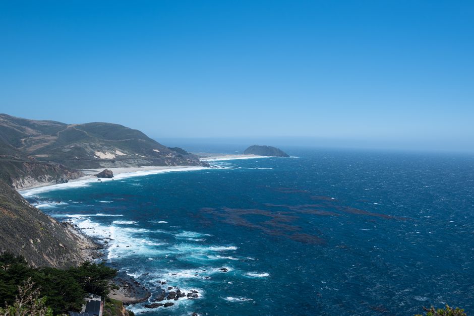
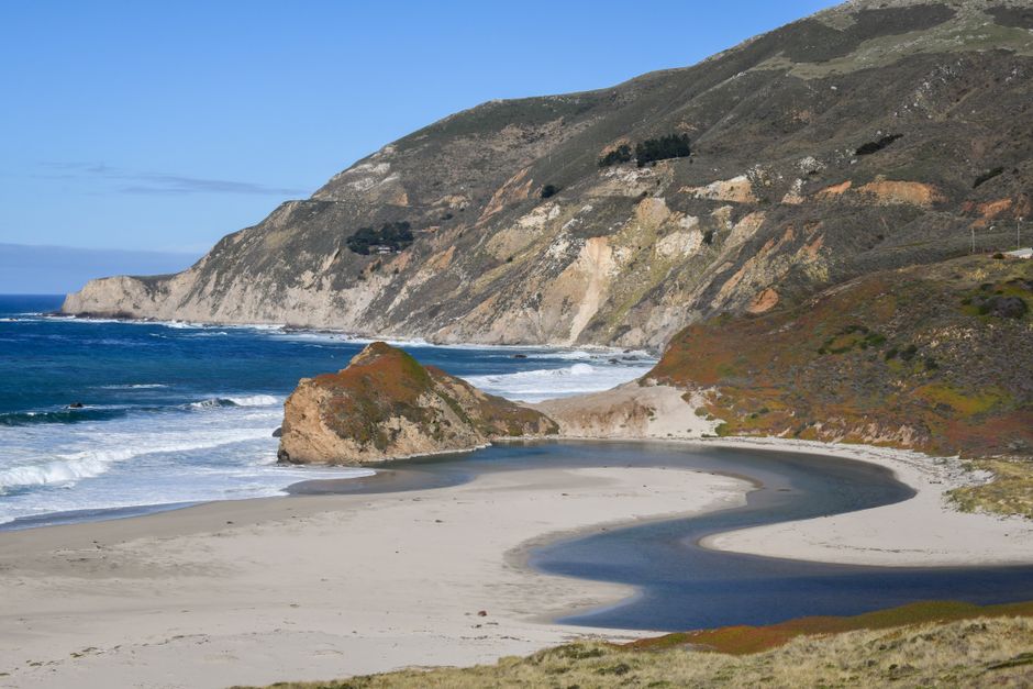
The California section offers the classic combination: beaches near Santa Barbara, cliffs around Big Sur, historic towns on the Monterey Peninsula and city scenery around San Francisco. The northern extension changes character. Expect colder weather, larger forests, fewer crowded viewpoints and longer stretches without a fuel stop or full-service restaurant.
Choose the experience before choosing the direction
A southern California route suits travelers who want beaches, mild evenings and an easy finish in Los Angeles. A northbound trip from Los Angeles places the ocean on the right side of the vehicle, but a southbound trip from San Francisco gives the driver and passengers more direct access to many ocean-facing pullouts. The difference is practical rather than dramatic, and safe stopping matters more than the direction.
What a realistic driving day looks like
Allow two to four hours of actual driving for a satisfying coastal day. Add time for short walks, viewpoint stops, food, traffic and parking. A route that takes three hours on a navigation screen can occupy seven hours once the road becomes part of the experience. The best Pacific Coast Highway road trip is measured in places explored, not miles completed.
How many days does the road trip need?
Use the itinerary length as a decision, not a suggestion
Three days covers one strong section. Five days works for a first trip between San Francisco and Los Angeles if the schedule stays focused. Seven days gives the central coast enough breathing room. Ten days or more makes it possible to add the northern forests without turning every day into a transfer.
| Trip length | Suggested route | Best for |
|---|---|---|
| 3 days | Monterey to Big Sur to Morro Bay | A focused coastal escape |
| 5 days | San Francisco to Monterey to Santa Barbara to Los Angeles | First-time visitors with limited leave |
| 7 days | San Francisco to Big Sur with two central-coast nights | A slower classic route |
| 10 days | San Francisco to Mendocino and the redwood coast | Cliffs, forests and smaller towns |
| 14 days | Los Angeles to the northern California coast | A broad coastal journey with recovery days |
The best default is seven days
Seven days is the strongest balance for most travelers. It allows a night near Monterey, two nights around Big Sur or the central coast, and enough time for San Francisco without forcing the entire trip into a sequence of check-ins and check-outs. Five days is workable, but it requires firm priorities. Fourteen days is better for travelers who want the northern coast, because long detours become enjoyable instead of disruptive.
Build around overnight bases
Pick two or three bases instead of changing accommodation every night. Monterey, Morro Bay, Santa Barbara and Mendocino each support several nearby stops. This reduces packing, keeps dawn and sunset available for scenery, and protects the plan when a road delay appears. One extra night in the most scenic region usually adds more value than another distant town.
Why a northbound start often works better
Start in San Francisco and drive south when the coastline is the main reason for the trip. The ocean-side lane makes many viewpoints easier to reach, and the scenery builds toward the Big Sur cliffs rather than revealing the most dramatic section on the first morning.
San Francisco to Monterey
Leave enough time for the coastal communities south of the city. Half Moon Bay and Santa Cruz provide easy breaks, while the Monterey Peninsula deserves more than a quick fuel stop. The route becomes more scenic as it approaches Carmel and Pacific Grove. A late arrival leaves little time for shoreline walks, so this first driving day works best when treated as a full day rather than a transfer.
Monterey to Big Sur
This is one of the shortest sections by mileage and one of the longest by experience. The road bends around headlands, crosses high bridges and passes viewpoints that can be missed when attention stays fixed on the next destination. Start early, carry food and water, and allow space for parking delays. Several stops have limited capacity, so a plan based on visiting every famous viewpoint will create unnecessary pressure.
Big Sur to the southern coast
The central coast rewards a flexible overnight plan. Morro Bay, San Luis Obispo and Santa Barbara each offer different scenery and a useful change of pace. Travelers who prefer quiet beaches should spend more time around Morro Bay. Travelers who want gardens, architecture and evening restaurants may prefer Santa Barbara. The clear choice for a first trip is not to rush from Big Sur to Los Angeles in one day.
Seven mistakes that ruin a Pacific Coast Highway trip
Fix the plan before leaving
- Trying to cover too much coastline. The road is slower than the map suggests. Set a maximum driving target and stop adding distant detours once the route is booked.
- Assuming Highway 1 is always open. Landslides, wildfires, rockfall and construction can close sections with little warning. Check the live state highway conditions page before departure and again each morning.
- Ignoring one-way traffic controls. Repair zones can add delays even when the road remains open. Keep a buffer before a timed tour, train or airport transfer.
- Arriving at parks without a reservation. Popular campgrounds and some guided activities can fill months ahead. State park reservations use a rolling booking window, so check availability as soon as the route dates are firm.
- Relying on a full tank at every stop. Fuel and food become less frequent in the northern sections. Refill before entering a remote stretch, especially when the next day includes forests or mountain roads.
- Stopping in unsafe places for photographs. Blind bends, narrow shoulders and unmarked pullouts are not viewpoints. A missed photograph is better than a blocked lane or a dangerous turn.
- Scheduling every hour. The route works because of small discoveries: a quiet beach, a short trail or a town worth exploring. Keep at least one unassigned block each day.
What to check the night before
Review road status, weather, daylight hours, parking rules and the next reliable fuel or food stop. Download maps for areas with weak service. Save the address of the next overnight base offline, since coastal coverage can disappear around cliffs and forests.
When to choose a different route
Do not choose the Pacific Coast Highway for a strict point-to-point schedule. Highway 101 or inland routes can be a better choice when reaching a destination matters more than scenery. They are also safer choices during major storms, active fires or confirmed closures. The coast should be treated as a flexible journey, not a guaranteed shortcut.
Pacific Coast Highway questions travelers ask
Is the Pacific Coast Highway difficult to drive?
Most of the route is manageable for an attentive driver, but the central and northern sections include tight curves, steep drops, narrow shoulders and limited passing opportunities. Drivers who dislike heights should avoid treating the road as a test. Break the route into shorter days, travel in daylight and let faster vehicles pass when safe.
Which direction has the best views?
Southbound travel usually places the ocean side closer to the vehicle and makes some coastal pullouts easier to enter. Northbound travel still offers excellent views and can work better for travelers finishing in San Francisco or continuing toward the redwood coast. Direction matters less than daylight, weather and enough time to stop safely.
What is the best month to go?
Late spring through early autumn often provides the most dependable combination of longer daylight and milder road conditions, but coastal fog can appear in any season. Summer brings heavier demand and fuller parking areas. Spring may bring greener hills, while autumn often offers calmer roads. Winter can be beautiful but requires more flexibility because storms may affect access.
Is the complete route worth doing?
Only when the trip has enough time. A focused California itinerary usually creates a stronger experience than a rushed drive from Southern California to the northern forests. The best choice for a first visit is seven days on one region, followed by a longer northern extension on a later trip if the slower pace proves worthwhile.
The Pacific Coast Highway is best experienced by choosing fewer stops, allowing extra time for road conditions, and treating the journey itself as the main destination.