The usual Tenerife problem appears halfway through the holiday: the map makes Teide National Park look close to the coast, but the roads climb from sea level to a volcanic plateau above the clouds. A morning in a fishing village can become a rushed mountain visit, while a badly timed Teide day can end with closed trails, cold weather and no time for dinner.
The best solution is to treat Tenerife as two connected landscapes rather than one sightseeing list. Give the high mountain a full block of time, then use the coastal villages for slower walks, local food and weather insurance. The route below suits independent travellers who want practical order, realistic driving times and a clear idea of what each place feels like.
How should a Tenerife Teide itinerary be structured?
Separate altitude from the coast
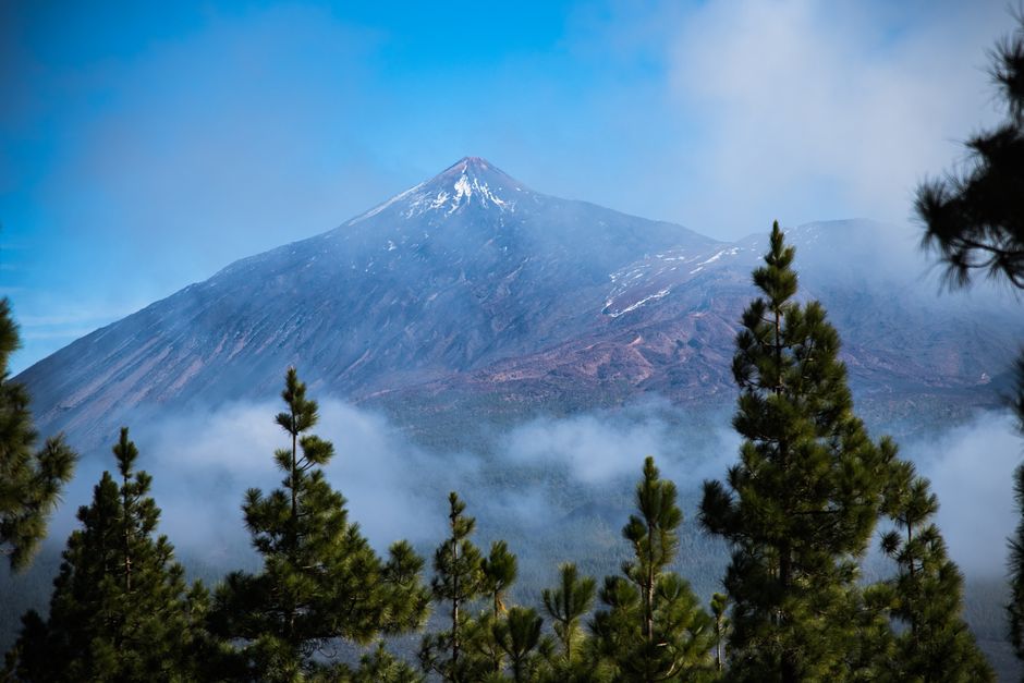
Teide National Park is not simply another viewpoint. Mount Teide rises to roughly 3,715 metres, and the road reaches a high volcanic plain where sunlight, wind and temperature feel different from the coast. Even travellers who feel comfortable at sea level may notice a faster heartbeat, a mild headache or unusual tiredness after arriving. That is why a mountain visit deserves an early start, unhurried walking and a flexible afternoon.
A strong itinerary alternates demanding and easy days. Place Teide after a relaxed coastal day, not after a late arrival or a long hike. The following day should remain light. The body may need time to adjust, and the park can be colder than expected even when the beach is warm.
Use villages as geographic anchors
La Orotava works well as a northern base because it sits below the park road and close to Puerto de la Cruz. Garachico and Icod de los Vinos form a useful northwest pair, with historic streets, volcanic scenery and sea views. On the west coast, Los Gigantes offers a different landscape of cliffs and open ocean. In the south, El Médano feels windier, flatter and more relaxed than the resort belt around Costa Adeje.
The practical rule is simple: combine nearby villages on one coastal day, but do not force a coast-to-Teide loop into a few spare hours. Roads are winding, parking is uneven and viewpoints invite delays. A good plan leaves at least two hours of daylight after returning from the mountain.
Which Tenerife coast fits a Teide trip best?
There is no single best coastal base. The north gives the strongest historic and rural atmosphere, the west gives dramatic scenery, and the south gives easier weather and a better chance of a late swim.
| Coastal area | Best for | What to expect |
|---|---|---|
| La Orotava and Puerto de la Cruz | Historic streets, gardens and northern landscapes | Greener scenery, cloud cover and cooler evenings |
| Garachico and Icod de los Vinos | Volcanic coast, old towns and short scenic stops | Compact villages, black-rock shorelines and winding roads |
| Los Gigantes | Cliff views and a west-coast sunset | Steep coastal scenery and limited flat walking |
| El Médano and the southeast | Wind, beaches and reliable dry weather | Open landscapes, strong breezes and a less historic feel |
The strongest all-round base
For a first visit focused on Teide and villages, the northern side wins. La Orotava gives easier access to the TF-21 mountain road and keeps Garachico, Icod and Puerto de la Cruz within reach. It also makes the contrast between humid green slopes and the dry volcanic plateau especially clear.
When the south is the better choice
Choose the southeast when warm evenings, beaches and dependable sunshine matter more than historic character. The drive to Teide is practical, but northern villages become a longer excursion. The south is the better choice for a mixed holiday where the national park occupies one day rather than shaping the entire trip.
How can visitors plan a safe Teide day?
Teide works best as a timed mountain day, not an improvised drive. Several routes require advance authorisation, and a cable-car ticket does not automatically grant access to regulated summit trails.
- Reserve the correct trail. The PNT 10 Telesforo Bravo trail connects La Rambleta, at about 3,550 metres, with the summit. Other regulated routes include PNT 07 Montaña Blanca–La Rambleta and additional high-altitude paths. The permit system and release schedule can change, so verify the exact trail rather than relying on an old screenshot or a third-party itinerary.
- Check the time window. PNT 10 controls both entry and exit, while PNT 07 uses the selected time mainly for entry. Arriving late can mean refusal even when the reservation is valid. Build in time for parking, toilets, queues and the walk to the control point.
- Pack for winter and sun. Take closed hiking shoes, warm layers, water, sun protection, food, a small emergency blanket and a charged phone. The summit area can be cold, windy or icy while the coast remains bright and mild.
- Keep the walking modest. The final summit section is short in distance but demanding because of altitude. Stop if dizziness, nausea, chest discomfort or severe headache appears. Descending is the correct response, not a test of willpower.
- Keep a fallback. If wind, ice, cloud or a closed lift changes the plan, use accessible viewpoints and lower trails instead of pushing into unsafe conditions. A cancelled summit does not have to become a wasted day.
A workable day sequence
Leave the coast early, reach the park with daylight, and allow two to three hours for viewpoints and short walks before any reserved summit slot. After the high section, descend by the same broad route and stop at a village for a late meal. Returning to the coast before dark is safer than adding a distant sunset viewpoint.
The mistake that causes most stress
The most common error is booking a summit permit first and arranging transport later. The final road section can be slow, parking can fill, and weather can interrupt the lift. Confirm the road, trail, transport and walking requirements as one plan.
What does Teide National Park feel like in practice?
Expect a landscape of layers
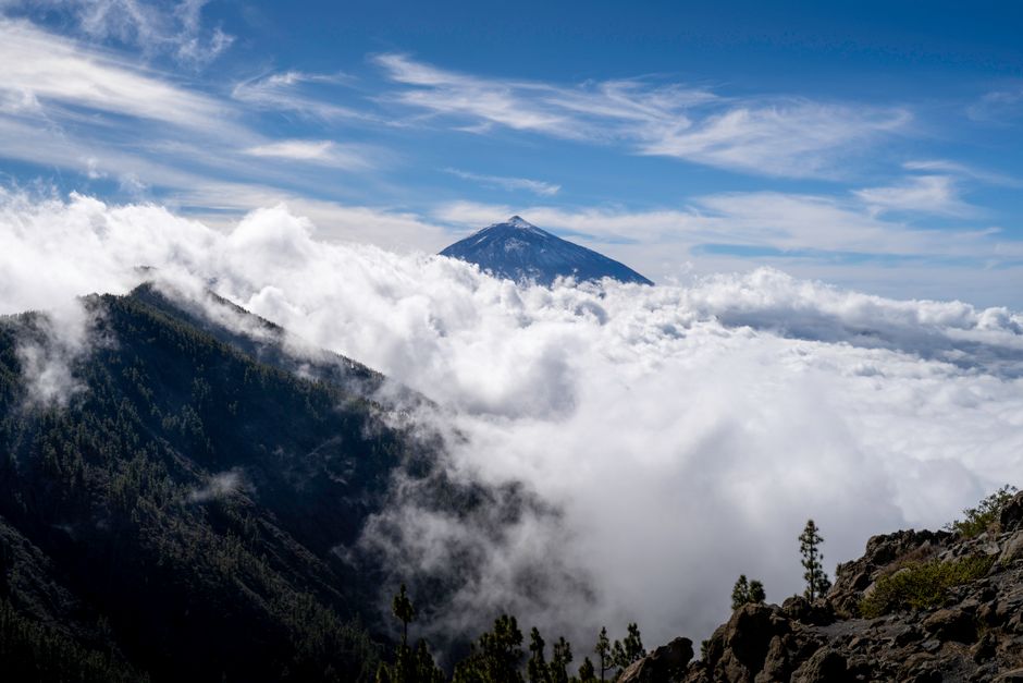
The park changes quickly as the road climbs. Pine forest gives way to pale lava, dark ridges, wide calderas and isolated rock formations. The views are not limited to one summit. Look for volcanic cones, old lava flows, long shadows and the sea of cloud that often gathers below the plateau. Short stops are valuable because each bend reveals a different geological texture.
The high plain can feel exposed. There is little shade, and the dry air makes water loss less obvious than it would be on the coast. Sun protection is needed even on a cool day. Wind can make the temperature drop sharply beside a viewpoint. A light jacket that stays in the day bag is more useful than beach clothing carried up from the hotel.
Understand altitude before choosing a walk
Elevation changes the meaning of distance. A route that looks easy on a map may feel slow after a steep climb, and recovery takes longer. Visitors who have recently arrived on Tenerife should start with viewpoints and short marked paths before attempting a longer ascent.
Do not leave marked trails to approach fragile lava formations. The park’s plants grow slowly, and informal shortcuts damage surfaces that may take years to recover. Quiet observation is part of the experience: wind, volcanic stone and wide space provide more than enough drama without a crowded schedule.
Which coastal villages are worth adding after Teide?
Is Garachico the best village for a historic stop?
Yes, for most itineraries. Garachico is compact enough for a slow walk and distinctive enough to feel different from a resort town. Explore the old streets, look across the volcanic shoreline and allow time for a simple meal. The coast is rugged rather than sandy, so the appeal lies in the setting and history, not in a classic beach afternoon.
What makes Icod de los Vinos useful?
Icod works well when the route needs a short inland-and-coastal combination. Its older centre is easy to pair with northern viewpoints, and the surrounding landscape shows how volcanic slopes support agriculture. It is a good stop before or after Garachico, but there is no need to rush through both villages in one hour. Two deliberate stops are better than five photographs from a car park.
When should La Orotava replace the western coast?
Choose La Orotava when architecture, gardens and a quieter evening matter more than ocean cliffs. Its sloping streets reward comfortable shoes, and the town makes a natural bridge between the northern coast and the Teide road. Choose Los Gigantes instead when the main goal is a dramatic coastal view, especially late in the day. These are different experiences, not interchangeable versions of the same stop.
A useful coastal rhythm is one village before lunch, one viewpoint or beach after lunch, and no more than one major drive. That pace leaves room for weather changes and the small details that make Tenerife feel lived-in.