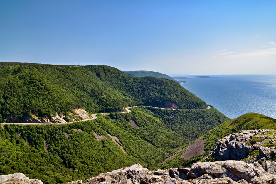
A common misconception is that the Cabot Trail is a single scenic drive that can be completed properly in one day. The full loop is about 298 kilometres and takes roughly four and a half hours without stops, but that calculation ignores hiking, weather delays, viewpoints, beaches, small communities, and slower mountain roads. A rushed loop is possible. A worthwhile road trip usually needs three to five days.
The route circles northern Cape Breton Island in Nova Scotia. It combines ocean cliffs, highland plateaus, Acadian and Gaelic culture, forest trails, and fishing communities. The practical question is not simply how to drive the loop. It is how to divide the route so that the best scenery does not become a sequence of parking-lot stops.
How Many Days Does the Cabot Trail Need?
Three days is the minimum sensible schedule; five days is the better choice for hikers, families, and travellers who want weather flexibility. The route can be driven in a day, but that approach leaves little time for the experiences that make the area distinctive. A useful plan gives each side of the loop at least one full day and keeps the final day flexible.
| Trip length | Best use | Suggested overnight pattern | Main limitation |
|---|---|---|---|
| 1 day | Scenic overview | One long driving day | Almost no hiking or weather margin |
| 3 days | First-time road trip | West side, north coast, east side | Only one substantial hike |
| 4 days | Balanced sightseeing | Two nights on one side, one on the other | Some stops still need choices |
| 5 days | Hiking, beaches, and local visits | Two bases with a spare day | Requires more accommodation planning |
Why a two-base plan works
Staying in both Chéticamp and Ingonish usually produces the most efficient trip. Chéticamp places travellers near the western entrance, coastal viewpoints, and the Skyline area. Ingonish works well for eastern beaches, Cape Smokey, Middle Head, and trails around the highlands. Baddeck is a useful starting or ending base, especially when the route is joined from the Trans-Canada Highway.
When one night is enough
One night can work for travellers who only want a sample of the route or who are continuing toward another part of Cape Breton. In that case, choose one section instead of pretending to see the entire loop. A shorter route with time for a walk is more satisfying than four hours of driving followed by darkness.
Which Direction Should the Cabot Trail Road Trip Follow?
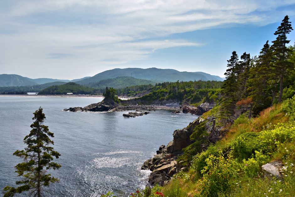
Counter-clockwise is the strongest choice for a first visit. It places many of the most dramatic ocean-facing views on the outside edge of the road and lets travellers approach the eastern highlands after the quieter western communities. The route is not dangerous for ordinary drivers, but it includes short steep grades, tight bends, changing weather, and sections where stopping safely requires patience.
Starting near Baddeck and travelling toward Ingonish creates a gradual transition from Bras d’Or Lake scenery to the open Atlantic coast. The eastern section then leads toward the highlands and the long views around Cape Breton Highlands National Park. Continuing west brings the route through Pleasant Bay, the northern coast, and Chéticamp before returning toward Baddeck.
Clockwise travel remains a good alternative for travellers who want to reach Chéticamp early, prefer to finish near Ingonish, or find better accommodation availability in the west. The important point is consistency. Pick a direction and avoid repeated backtracking across the same mountain roads.
What about the Englishtown Ferry?
The short cable ferry near Englishtown can connect the St. Ann’s area with the Cabot Trail. It is a useful route option, but daily operation can change because of weather, maintenance, or seasonal conditions. Check its status before building a tight schedule around the crossing. If the ferry is unavailable, the main highway route remains the dependable choice.
Where are the steepest sections?
Short climbs near Cape Smokey and the northern highlands deserve lower speeds, especially in rain, fog, or early-season conditions. Large vehicles and trailers need extra room on bends. The best driving verdict is simple: travel in daylight, leave space for slower traffic, and treat every signed pull-off as a safer stopping point than the road shoulder.
A Three-Day Cabot Trail Itinerary That Actually Works
A three-day plan should focus on sequence rather than collecting every attraction. The following schedule keeps the drive manageable and leaves room for one major hike plus several short stops.
- Day one: Baddeck to Chéticamp. Start with the western approach and allow time for viewpoints, coastal communities, and a short walk before reaching Chéticamp. Do not schedule a long trail on this day unless the drive begins early. The western coast rewards unplanned pauses, particularly when fog lifts from the cliffs or fishing boats are active offshore.
- Day two: Chéticamp through the highlands. Use the morning for the Skyline Trail or another route suited to the group’s fitness and weather. Skyline is about 6.5 kilometres for the shorter out-and-back option, but trail conditions, wind, and photo stops can extend the outing. After the hike, continue north toward Pleasant Bay and the highland viewpoints. A late arrival in Ingonish is acceptable only if dinner and lodging arrangements are already confirmed.
- Day three: Ingonish to Baddeck. Spend the morning around Ingonish Beach, Freshwater Lake, or Middle Head. The Freshwater Lake loop is short at roughly 1.7 kilometres, while Middle Head provides a longer coastal walk of about 5.3 kilometres. Continue south through Cape Smokey and St. Ann’s, adding the Englishtown Ferry only if its operating status fits the schedule.
This itinerary is deliberately selective. Adding every waterfall, beach, museum, and boat trip turns the trip into a checklist. The strongest three-day version includes one long walk, two short walks, and enough time to stop when the landscape changes.
What Should Drivers Expect on the Cabot Trail?
The Cabot Trail is a public highway through a large rural landscape, not a controlled scenic parkway. Mobile coverage can be uneven, fuel and food options are spread out, and a small delay can affect the rest of the day. Treat the route as a place where preparation improves freedom.
How does the weather affect the route?
Weather can change sharply between the coast and the highlands. A clear morning at sea level may become cold, windy, or foggy near an exposed viewpoint. Pack a warm layer, rain protection, water, and footwear that can handle wet ground even during summer. In autumn, shorter daylight hours make late trail starts a poor choice. In spring and fall, check road conditions before leaving each morning.
What should be booked or checked in advance?
Accommodation in Chéticamp, Pleasant Bay, and Ingonish can be limited during peak summer and fall colour periods. Reserve lodging before committing to a fixed loop. Check trail conditions, ferry operation, park notices, and visitor-centre hours on the same day as departure because closures can change the practical route. Some trails may be closed because of wildlife activity, storm damage, maintenance, or unsafe conditions.
How should wildlife and hiking be handled?
Moose, coyotes, seabirds, and marine wildlife live around the route. Never feed animals, leave food unattended, or approach a wild animal for a photograph. Hikers should stay on marked paths, carry water, tell someone the planned trail, and keep children close near cliffs and shorelines. If an animal approaches, create distance slowly rather than running. A trail closure is a safety instruction, not a suggestion.
The main failure mode is underestimating time. A map may show two stops only a few minutes apart, yet parking, walking, wind, fog, and a slow vehicle can add an hour. Build at least one open block into each day. The best road trip is not the one with the most pins saved on a map; it is the one that still feels calm when conditions change.
The Mistakes That Ruin a Cabot Trail Loop
The clearest recommendation is to plan fewer stops and protect daylight. Most disappointing trips fail because the itinerary treats distance as the only variable. These are the mistakes that cause the most trouble:
- Driving the entire loop in one day. This works only as a quick overview. It leaves no meaningful time for trails, beaches, local food, or weather delays. Choose one section if only a day is available.
- Using one base for every night. A single base can simplify packing, but it creates repeated long drives. Two bases usually provide more time outdoors and less time retracing the same route.
- Scheduling a major hike after a long transfer. Fatigue makes steep trails and exposed viewpoints less enjoyable. Place the main hike near the start of a day, not at the end.
- Ignoring seasonal services. Some visitor centres, restaurants, tours, and campgrounds operate only during the main travel season. Confirm opening dates instead of assuming a map listing is current.
- Stopping on unsafe shoulders. Narrow roads, blind curves, and soft edges create avoidable risks. Continue to the next signed pull-off, even when the view appears perfect.
- Treating the weather forecast as fixed. The forecast for Baddeck may not describe conditions on the plateau. Carry layers and keep a backup walk or beach stop ready.
For most travellers, the best plan is a four-day counter-clockwise loop with nights divided between Chéticamp and Ingonish, one major hike, two short walks, and a spare half-day for weather. That structure delivers the Cabot Trail’s strongest scenery without turning the trip into a race.